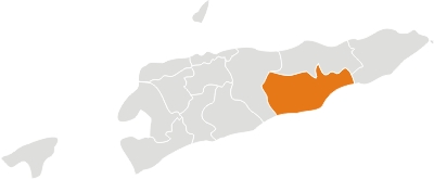
The territory of Timor-Leste comprises the eastern half of the Island of Timor; the Atauro Island, north of Dili; the Jaco Island, on the easternmost end of the island; and Oecussi, an enclave on the northwestern side of the island, within Indonesia. The territory has a population of about 1,066,409 inhabitants (Census 2010), distributed within an area of approximately 15,000 km². The national capital is Dili.
In 1908, Portugal divided the Timorese territory into 15 military commands, responsible for the decentralization of the civil administration. One decade later, the Portuguese metropolis created the first civil circumscriptions, which divided military power, since it had become superfluous after the signing of the Arbitral Sentence in 1914 with the Netherlands. The first municipality – Dili – was only created in 1940. After that, many other municipalities and circumscriptions coexisted, until the last circumscription (Oecussi-Ambeno) was given the status of municipality in August 1973.
By the mid-1960s, the Portuguese administration was organized into 11 municipalities, namely Bobonaro, Cova-Lima, Liquiça, Ermera, Dili, Ainaro, Same, Manatuto, Baucau, Viqueque and Lautem; and one circumscription, the enclave of Oecussi-Ambeno. The borders of these divisions were similar to those of present-day districts; however, there are three differences: the municipality of Aileu was separated from Dili during the last years of the Portuguese administration; and, under the Indonesian administration, the subdistrict of Turiscai, formerly a part of the Ainaro district, was transferred to Manufahi. As a result, Hato Udo was taken from Manufahi and given to Ainaro. Among all of the districts in Timor-Leste, Viqueque is the largest, with an area of 884 km², and Dili the smallest (364 km²).
Districts
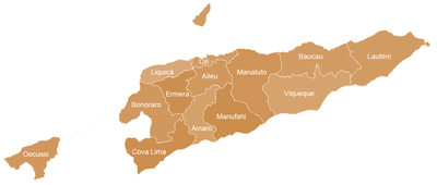
As far as administrative division is concerned, Timor-Leste is split into 13 districts: Bobonaro, Liquiçá, Díli, Baucau, Manatuto and Lautém on the north coast; Cova-Lima, Ainaro, Manufahi and Viqueque, on the south coast; Ermera and Aileu, the two landlocked districts; and Oecussi-Ambeno, the enclave in Indonesian territory. The borders determining the 13 districts have been more or less the same since the last years of Portuguese administration. Each district comprises one capital city and various subdistricts whose number can vary between three and seven, with an average of five subdistricts per district. Demographically, Dili is the district where the majority of the population is concentrated, while Aileu registers the lowest population rate, although its area is superior to Dili’s.
Subdistricts
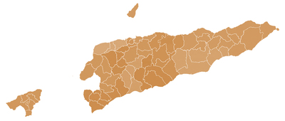
The 13 districts are subdivided into 67 sub-districts, with one designated as the capital, and administrative subdivisions – the so-called sukus (villages) – which vary between 2 and 18 per subdistrict. The largest subdistrict is Lospalos, in Lautem, with an area of 635 km², while Nain Feto in Dili is considered to be the smallest, with 6 km². Fatululik, one of the smallest subdistricts, is the less populated with approximately two thousand inhabitants. The subdistricts which present higher demographic rates are the ones belonging to the district of Dili, specifically those surrounding the national capital.
Villages
The smallest administrative division in Timor-Leste is the suku (village), which can comprise one or many aldeias (hamlets). The territory is divided into 498 villages, an average of seven per subdistrict. Baucau has more villages (63) than any other district, while Ainaro is the district with the least divisions (21 villages). Based on the average number of villages per subdistrict, the most central districts are the ones with more administrative segments. Aileu and Ermera have the highest average number, 11 villages per district, and Ainaro and Oecussi-Ambeno the lowest, with five villages per subdistrict. The most central and mountainous subdistricts with the highest number of villages are: Aileu, in the Aileu district, and Bobonaro, in the Bobonaro district, with 18 divisions each; however, the subdistricts of Hato Udo, in Ainaro, and Tutuala, in Lautem, which lie near the coast, have only two villages each.
In regards to area, the largest villages lie on the easternmost part of Timor-Leste, specifically Laline in the subdistrict of Lacluta, Viqueque, with 212 km². Dili comprises the smallest villages (15 altogether), similar to neighborhoods (the so called bairos), with areas between 2 km² and 0.06 km2. The population distribution is highly uneven. Among the four villages that constitute the subdistrict of Fatululik, in Cova-Lima, two have a population of less than 500 inhabitants. One of these villages has only 135 people, being the least populated village in Timor-Leste. As expected, the villages with high demographic rates (over 5,000 inhabitants per square kilometer) belong to the Dili district, namely to the Dom Aleixo subdistrict. The most populated village is Fuiloro in Lospalos, in the Lautem district, with a population of 10,000 inhabitants.
Brief Description by District
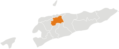
It lies in the highlands to the south of Dili, the national capital. It has a population of 44.325 (Census 2010) and an area of 729 km², with a demographic density of 50,6 h/km². The capital of the district is also named Aileu. This district used to belong to Dili municipality and was only given its autonomy during the last years of the Portuguese administration. Aileu district comprises the subdistricts of Aileu, Laulara, Liquidoe and Remexio.
Located in the southwest part of the country. It has a population of 59.175 inhabitants (Census 2010) and an area of 797 km². The capital of the district is also named Ainaro. Ainaro district is identical to that of the same in Portuguese Timor, with the following exceptions: during the Indonesian administration, the subdistrict of Turiscai became part of Manufahi, while the subdistrict of Hatudo became part of Ainaro in exchange. Ainaro district comprises today the subdistricts of Ainaro, Hatudo, Hatu Builico and Maubisse. Ainaro has a great abundance of rivers and fertile soil for agriculture. It has a coastal area on the south part of the island, but also mountain ranges, such as the Mount Ramelau (2.960 m) which forms the highest peak in the country. Ainaro played an important role during the Resistance period due to its topographic features which provided shelter for the guerrilla. In addition to the official languages of the country (Tetun and Portuguese), the majority of the population speaks Mambai.
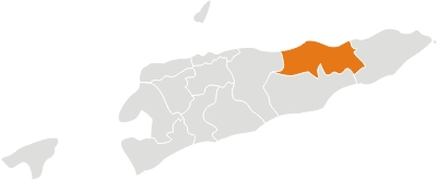
Baucau is located on the eastern part of the country, around 122 km of Dili. It is the second biggest city of the country with a population of 111.694 inhabitants (Census 2010) and an area of 1.494 km². The capital of the district is also named Baucau. During the Portuguese colonization, it was called Vila Salazar, after the Portuguese dictator. Baucau District comprises the subdistricts of Baguia, Baucau, Fatu Maca, Laga, Quelicai, Vemasse and Venilale (formely known as Vila Viçosa). Baucau has the country’s biggest international airport (IATA code: NCH) at 6 km from the city, which is now inoperative for commercial flights. The tunnels in the subdistrict of Venilale (ex-Vila Viçosa) are a legacy of the Japanese occupation during the Second World War. The main economic activity of Baucau is agriculture (corn, rice, peanut, coconut and horticultural crops). With the gradual improvement of the transport system and the provision of electric power, the private sector and the small and medium enterprises are now registering a progressive development. Baucau offers a wide coastline with attractive beaches, ideal for swimming and other water sports. In addition to the official languages of the country (Tetun and Portuguese), the majority of the population speaks Macassai.
It is located on the western part of the country, and borders Indonesia to the west. It has a population of 92.049 inhabitants (Census 2010) and an area of 1.368 km². The capital of Bobonaro is Maliana, 149 km southwest of Dili, the national capital. Bobonaro district is identical to that of the same in Portuguese Timor, with the only difference that its capital was formerly called Vila Armindo Monteiro. The district includes the subdistricts of Atabae, Balibó, Bobonaro, Cailaco, Lolotoi and Maliana.
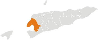
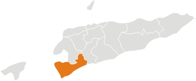
It is located on the western part of the country and borders Indonesia to the west. It has a population of 59.455 inhabitants (Census 2010) and an area of 1.226 km². The capital of Cova Lima is Suai which lies 136 km southwest of Dili, the national capital. Cova Lima district comprises the subdistricts of Fatululik, Fatumean, Fohorem, Zumulai, Maucatar, Suai and Tilomar.
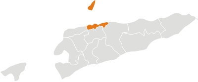
Lies on the north coast of the island. It borders the districts of Manatuto to the east, Aileu to the south, Liquiça to the west and the Savu Sea to the north; it comprises also Atauro Island to the north. It has a population of 234.026 inhabitants (Census 2010) and an area of 372 km². It is the country’s smallest district. Its capital is the city of Dili which is also the national capital. The district is identical to that of the same in Portuguese Timor, with the only difference that it used to comprise the municipality (today district) of Aileu. Dili comprises the subdistricts of Atauro, Cristo-Rei, Dom Aleixo, Nain Feto, Metinaro and Vera Cruz.
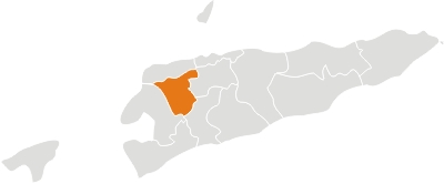
Located in the central part of the country. It has a population of 117.064 inhabitants (Census 2010) and an area of 746 km². The capital of Ermera is Gleno, 58 km southwest of Dili, the national capital. Ermera comprises the subdistricts of Atsabe, Ermera, Hatólia, Letefuó and Railaco. Among other agricultural practices, Ermera distinguishes itself as one of the major coffee growing areas.
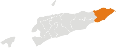
Lies on the eastern end of Timor Island; it also includes Jaco island. It has a population of 59.787 inhabitants (Census 2010) and an area of 1.702 km². The capital of Lautem is Lospalos, 248 km east of Dili, the national capital. The district is identical to that of the same in Portuguese Timor. At that time, many areas had Portuguese names, such as Vila Nova de Malaca (today Lautem), Nova Nazaré (Com), Nova Sagres (Tutuala), Nova Âncora (Laivai) and Silvícola (Loré), among others. Lautem comprises the subdistricts of Iliomar, Lautem Moro, Lospalos, Luro and Tutuala. In addition to the official languages of the country (Tetun and Portuguese), the population speaks Fataluku, a Papuan language spoken in the islands of New Guinea.
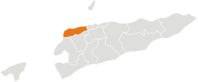
Located on the northern coast of the country, about 32 km of Dili. It borders the districts of Bobonaro and Ermera to the south; Dili to the east; and the Savu Sea to the northwest. It has a population of 63.403 inhabitants (Census 2010) and an area of 543 km². The capital of the district is also named Liquiça. Liquiça comprises the subdistricts of Bazartete, Liquiça and Maubara. The rocky beach is one of the main attractions for tourists in Liquiça. In addition to the official languages of the country (Tetun and Portuguese), the majority of the population speaks Tocodede.
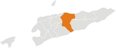
Located in the central part of the country; it reaches both the south and north coasts of the island. It borders the Strait of Wetar to the north; the districts of Baucau and Viqueque to the east; the Timor Sea to the south; and the districts of Manufahi, Aileu and Dili to the west. It has a population of 42.742 inhabitants (Census 2010) and an area of 1.706 km². The capital of the district is also named Manatuto. The longest river in Timor-Leste, the Laclo river, reaches the sea near Manatuto, between the Ponta de Subaio and Lanessana bay. Manatuto comprises the subdistricts of Barique-Natarbora, Laclo, Laclubar, Laleia, Manatuto and Soibada. In addition to the official languages (Tetun and Portuguese), the majority of the population speaks Galóli, which is recognized as a “national language” by the Constitution.
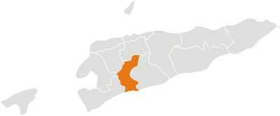
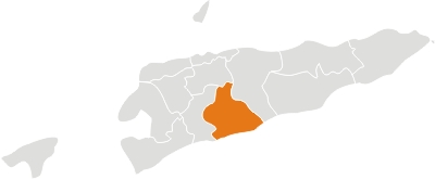
Located on the south coast of the island, it borders the district of Manatuto to the east, Aileu to the north, Ainaro to the west and the Timor Sea to the south. It has a population of 48.628 inhabitants (Census 2010) and an area of 1.325 km². The capital of the district is Same. In 1945, during the Portuguese Timor, this district was also called Same. It now comprises the subdistricts of Alas, Fatuberliu, Same and Turiscai. The latter – Turiscai, previously in Ainaro, was moved to Manufahi during the Indonesian administration, while Hatudo was split off from Manufahi and joined to Ainaro. In addition to the official languages of the country (Tetun and Portuguese), the majority of the population speaks Mambai.
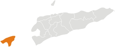
Located on the north coast of the western part of Timor Island. It is separated from the rest of Timor-Leste by the Indonesian territory which surrounds the small enclave in all directions, except to the north, where it borders the Savu Sea. The district of Oecussi-Ambeno was named after the two original kingdoms which now constitute the district. The territory has 64.025 inhabitants (Census 2010) and an area of 815 km². The capital is the city of Pante Macassar, formerly known as Vila Taveiro during the Portuguese administration. The district of Oecussi-Ambeno is identical to that of the same in Portuguese Timor. It was the last Timorese circumscription elevated to district in August 1973. It now includes the subdistricts of Nitibe, Oesilo, Pante Macassar and Passabe.
Oecussi-Ambeno was the first place on which the Portuguese established themselves at their arrival. This is the reason why the district is considered the cradle of Timor-Leste. In 1556, a group of Dominican brothers established the first village in Lifau, six kilometers to the west of Pante Macassar. In 1702, Lifau became the capital of the colony when it received the first governor from Lisbon. It held the status until 1767, when the Portuguese decided to transfer the capital to Dili, as a result of the frequent attacks by the Dutch forces. It was only in 1859, with the Treaty of Lisbon, that Portugal and the Netherlands divided the island: West Timor was given to the Dutch, with its colonial seat in Kupang, and Timor-Leste became Portuguese, with its seat in Dili. Portugal recognized Oecussi-Ambeno as a Portuguese enclave surrounded by Dutch territory.
The Indonesian invasion of the Portuguese Timor was launched over the western part of the island, namely through Oecussi, on November 29th, 1975, a week before the official invasion. On that day, an Indonesian fifth column raised the Indonesian flag in Pante Macassar. However, even under Indonesian rule, Oecussi-Ambeno continued to be administrated as part of the province of Timor Timur. Therefore, following the recognition of the independence of Timor-Leste, in 2002, Oecussi-Ambeno became naturally a segment of the Timorese nation. In addition to the official languages (Tetun and Portuguese), a great part of the population speaks Baikeno.
Located on the south coast of the island. It borders the district of Lautem to the east, Baucau to the north, Manatuto to the west and the Timor Sea to the south. It has a population of 70.036 inhabitants (Census 2010) and an area of 1.781 km². The capital of the district is also named Viqueque. The Viqueque district comprises the subdistricts of Lacluta, Ossu, Uatolari (formely called Leça), Uato Carabau and Viqueque. In addition to the official languages of the country (Tetun and Portuguese), the majority of the population speaks Macassai.
